|
|
Welcome to FloridaBusinessReview.com Florida County Listings
You can search our database for Florida Businesses or Florida Golf Courses by county.
If your Business or Golf Course is located in Florida and it is not listed in our database you can click on the 'Add my business listing' button below to add your business or click on the ' Add my golf course' button below to add your golf course.
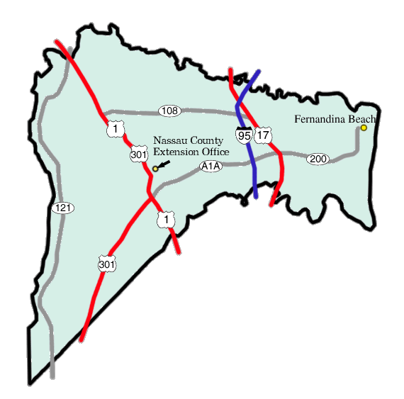
County Listing for: Nassau County Florida
Facts for: Nassau County Florida
Nassau County is a county located in the state of Florida. As of 2000, the population was 57,663. The U.S. Census Bureau 2005 estimate for the county is 64,747 [1]. Its county seat is Fernandina Beach, Florida6.
Nassau County is part of the Greater Jacksonville Metropolitan area.
Nassau County was created in 1824. It was named for the Duchy of Nassau in Germany.
Nassau County is governed by the five-member Nassau County Board of County Commissioners, who are elected to four-year terms by the voters. The terms are staggered so that either three or two commissioners (alternately) are up for election every two years.
The main environmental and agricultural body is the Nassau County Soil and Water Conservation District, which works closely with other area agencies.
According to the U.S. Census Bureau, the county has a total area of 1,880 km² (726 sq mi). 1,688 km² (652 sq mi) of it is land and 192 km² (74 sq mi) of it is water, much of it in the Atlantic Ocean. The total area is 10.24% water. Fernandina Beach is located on Amelia Island, the county's one inhabited island.
There are 12 distinct topographical zones in Nassau County. Most of these zones run in narrow bands stretching from north to south, although this is less true as one approaches the Atlantic coast.
1. Directly against the western border with Baker County, the topography ranges from fairly flat to slightly elevated. Drainage is poor and the soil is sandy.
2. Moving east, there are some areas (mostly in the northern and central county) of higher ground with much better drainage.
3. East of these areas are some lower places, especially in the south, that are level and have extremely poor drainage.
4. Eastward again, there is a stretch that ranges from a few miles in the extreme northern areas to about 6-8 miles wide in the southern area, including Hilliard and much of County Road 108 and State Road 301. This area again has very poor drainage, low-lying land, and fairly sandy soil.
5. East of this are scattered areas of high, sandy land with spotty or poor drainage.
6. East of this, there is an area including Callahan with very sandy soil on top, and clay underneath. This section of the county is heavily permeated by small creeks and rivers, which bring with them low, poorly drained soils. This zone extends across the entire county from north to south at a fairly consistent width of about 3-4 miles, except in the north, where it widens to nearly 6 miles across.
7. East of this area is a large band of land with a consistent width of about 8 miles. The land is low and level with extremely poor drainage, and it is permeated by small creeks and rivers. In the northern section, this is where some tributaries join the St. Mary's River, while in the south a number of tributaries drain together into the Nassau River, which flows into the Nassau Sound and the Atlantic Ocean.
8. East of this area is a section of land about 3 miles in width that has extremely sandy soils with bad drainage all around.
9. Further eastward is a large area, including Yulee and O'Neil, about 4 miles in width, with poor drainage and sandy soil at higher elevations, pockmarked by large reas of low lands with even worse drainage.
10. To the south is an area of low-lying, organic soils which are essentially marshes and wetlands along the northern bank of the Nassau River, continuing into the Nassau Sound.
11. Still eastward and somewhat to the north is a large area of marshes and organic soils which characterize area wetlands. There are many small islands in this area, and it is permeated by the Bells River and Jolly River, which empty into the Cumberland Sound to the north, just below Cumberland Island.
12. Amelia Island, the easternmost section of the county, is characterized by poor drainage in the west and better drained, higher, sandier land as one travels eastward towards the beach. The northern area of the Island features salty marshlands surrounding Egan's Creek, which runs directly beneath Atlantic Boulevard in Fernandina Beach.
Nassau County's economy is very diverse, ranging from agricultural activity (mostly in the form of tree farms) in the west and central areas, to a variety of activities closer to Amelia Island. Much of the land used for tree farming is owned by Rayonier, a major employer in the area, and the owner of a large pulp mill in Fernandina Beach. Historically, tree farming, trucking, and pulp production has characterized a large portion of the local economy. However, extensive growth is occurring in the outlying small towns in the rural western area, and the home construction market is still quite strong. Fernandina Beach has long been known for professional industries such as real estate, legal services, and medical care, and is also a site of some upscale resorts such as the Ritz-Carlton Hotel and Amelia Island Plantation. In the central area of the county, a private tract of land known as White Oak Plantation was once owned by a wealthy family who ran the area as a private zoo, complete with exotic animals such as giraffes and large albino cats. Numerous public figures, including former President Bill Clinton, have travelled to the resort in the past as a vacation spot.
As of the census² of 2000, there were 57,663 people, 21,980 households, and 16,528 families residing in the county. The population density was 34/km² (88/sq mi). There were 25,917 housing units at an average density of 15/km² (40/sq mi). The racial makeup of the county was 90.02% White, 7.74% Black or African American, 0.43% Native American, 0.46% Asian, 0.03% Pacific Islander, 0.32% from other races, and 1.00% from two or more races. 1.51% of the population were Hispanic or Latino of any race.
There were 21,980 households out of which 32.80% had children under the age of 18 living with them, 61.20% were married couples living together, 9.90% had a female householder with no husband present, and 24.80% were non-families. 20.10% of all households were made up of individuals and 7.70% had someone living alone who was 65 years of age or older. The average household size was 2.59 and the average family size was 2.97.
In the county the population was spread out with 25.00% under the age of 18, 7.20% from 18 to 24, 28.80% from 25 to 44, 26.30% from 45 to 64, and 12.60% who were 65 years of age or older. The median age was 38 years. For every 100 females there were 97.30 males. For every 100 females age 18 and over, there were 94.80 males.
The median income for a household in the county was $46,022, and the median income for a family was $52,477. Males had a median income of $37,027 versus $25,443 for females. The per capita income for the county was $22,836. About 6.40% of families and 9.10% of the population were below the poverty line, including 10.90% of those under age 18 and 8.90% of those age 65 or over.
View listings for: Nassau County Florida
|
![]()
|